Built from feedback: Vision Link's UK-developed flood apps
Our customers told us that web portals and email weren't enough. They needed fast, clear information in the field, on the phone in their pocket. In response, our UK-based team developed FloodEye and FloodEye Community.
Both apps are fully integrated with the Environment Agency flood warning service. They show live flood alerts, river levels and flood maps alongside live weather updates from the Met Office and real-time data from Vision Link cameras and sensors. Everything is in one place, so you don't have to switch between websites.
The apps are developed entirely in-house, which gives us full control over functionality, performance and data security. They work on iPhone, iPad and Android straight from your browser, with no app store needed.
✅ Free to use
✅ Ad-free
✅ No subscription fees
Whether you're a site manager, maintenance engineer, flood warden or concerned resident, FloodEye puts the information you need in your hand, wherever you are.
FloodEye Professional
FloodEye
For Vision Link customers and professional users
FloodEye is our full-featured app for the organisations that own and run Vision Link monitoring systems: site managers, maintenance engineers, field teams and asset owners. It shows live camera images, water level telemetry, Environment Agency flood alerts and river gauge data, interactive maps and river level graphs in one place. You get instant alerts and notifications, so you can make quick, informed decisions without logging into a computer or visiting the site.
FloodEye Community
FloodEye Community
For flood groups, parish and local councils, and the public
FloodEye Community is a free, simplified version of FloodEye for anyone who wants to keep an eye on local conditions. It runs on the same technology as FloodEye. You can see live camera snapshots, water level readings, Environment Agency flood warnings, flood warning area maps and local weather. There's no login and no technical know-how needed. It suits flood action groups, flood wardens, parish councils and residents who want early warning when bad weather is on the way.
Both apps are: free · ad-free · no subscription · work on iPhone, iPad and Android · no app store needed: add to your home screen from your browser · developed in-house by our UK team
See what's happening on site, and what happened before
The apps give you two ways to view your site: high-resolution still images and HD video. Both let you scroll back in time, so you can see how conditions changed over hours or days rather than only the latest view.
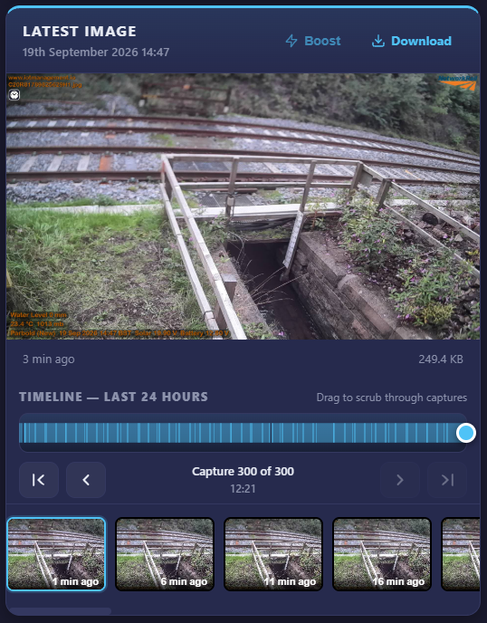
Image viewer
Still images are captured in Full HD (1080p), with enough detail to read water levels, gauge boards and debris. Scroll back through the image history to compare conditions and follow how an event developed. Any image can be downloaded straight to your device, ready to use in site reports or flood group updates.
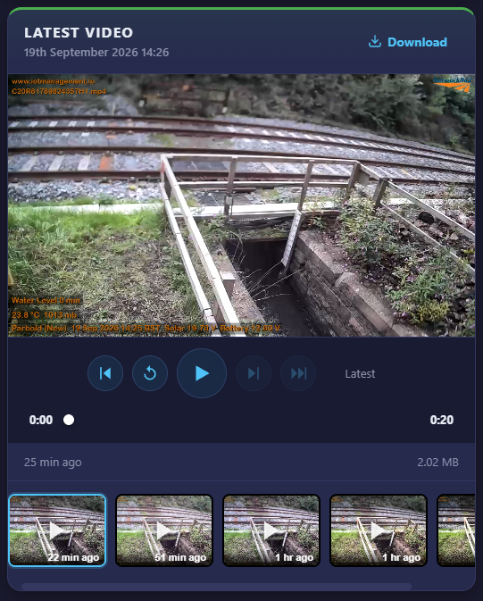
Video viewer
Video is recorded in HD (720p). You can scroll back through recordings to see exactly how an event unfolded. Clips can be downloaded straight to your phone, tablet or computer. They use industry-standard H.264 encoding, so they play on any device or platform without special software, which makes them easy to share with your team or your community.
Our own AI, working behind every camera
Every Vision Link camera is backed by our own AI, which we designed, trained and developed in-house. It was trained on years of images from our own cameras on real sites. That lets it recognise what's normal at each location and pick out what has changed, such as rising or standing water, blocked screens, debris or obstructions. It can also tell the difference between a real problem and passing trains or road traffic.
Where privacy matters, face and vehicle number plate blurring can be switched on, so footage is protected before anyone views it.
FULLY INTERGRATED HIGH RESOLUTION WATER LEVEL SENSOR

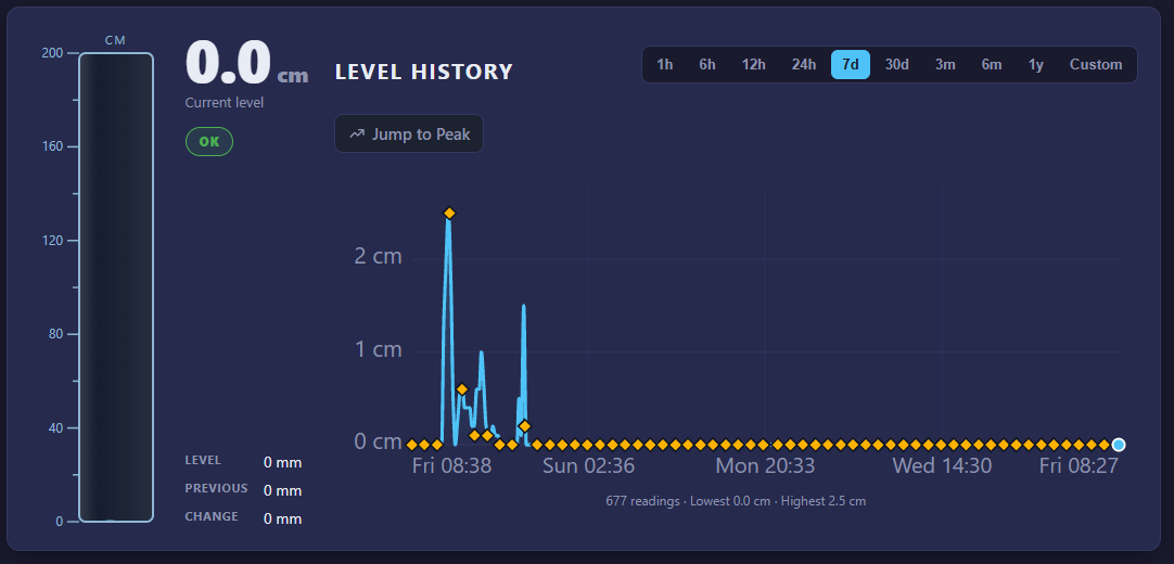
Our hydrostatic water level sensor plugs directly into the Vision Link camera, so camera and sensor work as one system. It takes a reading every few minutes, and the readings appear in the apps as live levels and graphs alongside the camera images. That way you can see the water level and what's happening on site at the same time.
The sensor measures true water depth from the pressure of the water above it. It has no moving parts and doesn't need line of sight, so foam, turbulence, mist and condensation don't affect it the way they can affect ultrasonic or radar sensors. It's well suited to rivers, culverts, reservoirs and flood defences.
ENVIRONMENT AGENCY RIVER GAUGES

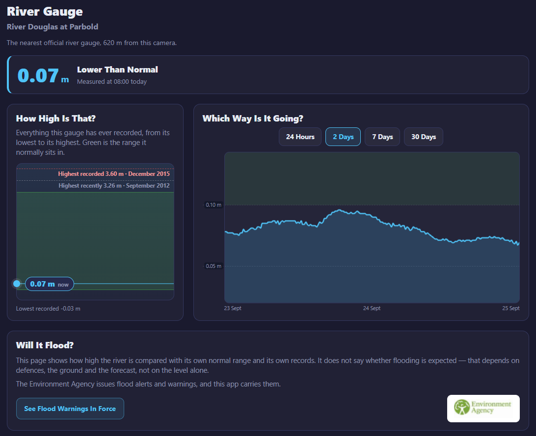
The Environment Agency runs a network of about 3,200 river level monitoring stations across England. Readings are usually taken every 15 minutes and are sent in more often when there's a risk of flooding. Flood warnings in England are issued from this data.
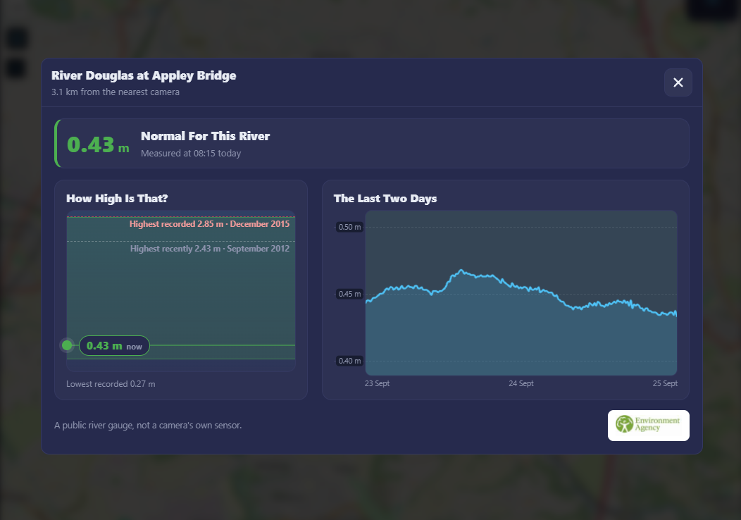
Every Vision Link camera has built-in GPS, so it finds the nearest Environment Agency river gauge by itself, with no setup needed. The apps show that gauge's current reading and whether the river is rising or falling, along with any flood warnings in force for the area, from a Flood Alert up to a Severe Flood Warning.
You see the official river data and a live view of your own site side by side. That shows you what's happening on the river and what it means on the ground, all in one place.
Interactive maps
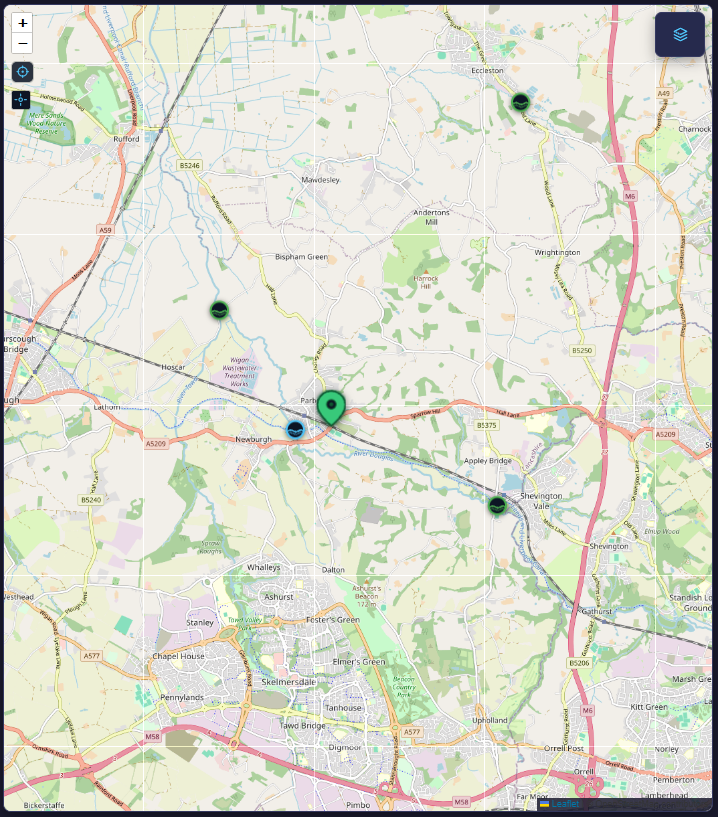
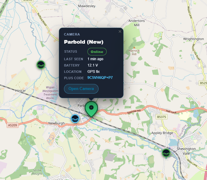
The apps include a live interactive map showing Vision Link cameras and Environment Agency river gauges in your area, together with the flood warning areas currently in force. Each camera and gauge has its own map icon. Tap one to get its information straight away:
Camera icons show the latest image and readings from that site.
River gauge icons show the current river level and whether it's rising or falling.
You can move around the map to see conditions at a glance across a whole catchment, then zoom in and tap through to the site that matters to you. It's a quick, easy way to understand what's happening across the area.